Our Services
Our Services include but are not limited to Land Management, Search & Recovery, and Property and Infrastructure Assessments
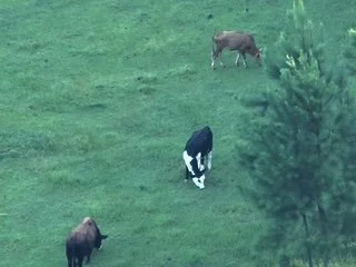
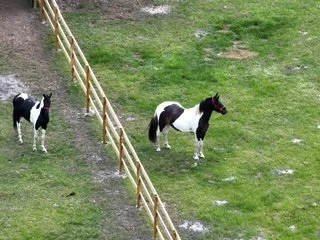
Herd & Predator Analysis
Pricing Call for Custom Quote
Using thermal drones, we can safely monitor livestock health, movement, and location while also detecting potential predator threats. This reduces stress on the animals and provides farmers and ranchers with accurate insights without the need for disruptive ground checks.
Orthomosaic Mapping
Our drones create high-resolution, georeferenced maps that provide precise data for land planning, crop management, and property assessment. This gives landowners and managers a cost-effective way to survey large areas quickly, with more detail and accuracy than traditional methods.
Benefits of Using a Drone
Drones reduce costs, save time, and provide safer access to areas that would otherwise require heavy equipment or risky manual inspections. They deliver accurate, real-time data from the air, giving land managers a smarter way to monitor and protect their property.
For All of Our Services Contact Us at 904-860-0968
Property & Infrastructure Assessments
Pricing Call for Custom Quote
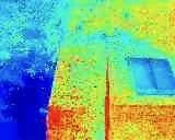
Solar Farm Assessments
Drones equipped with thermal imaging can quickly detect faulty panels, wiring issues, or energy losses across large solar farms. This ensures maximum efficiency while reducing costly downtime.
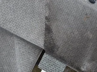
Roof Assessments
Aerial drones safely capture detailed imagery of rooftops to spot leaks, damage, or wear without the need for risky manual climbs. This allows property owners to plan repairs quickly and cost-effectively.
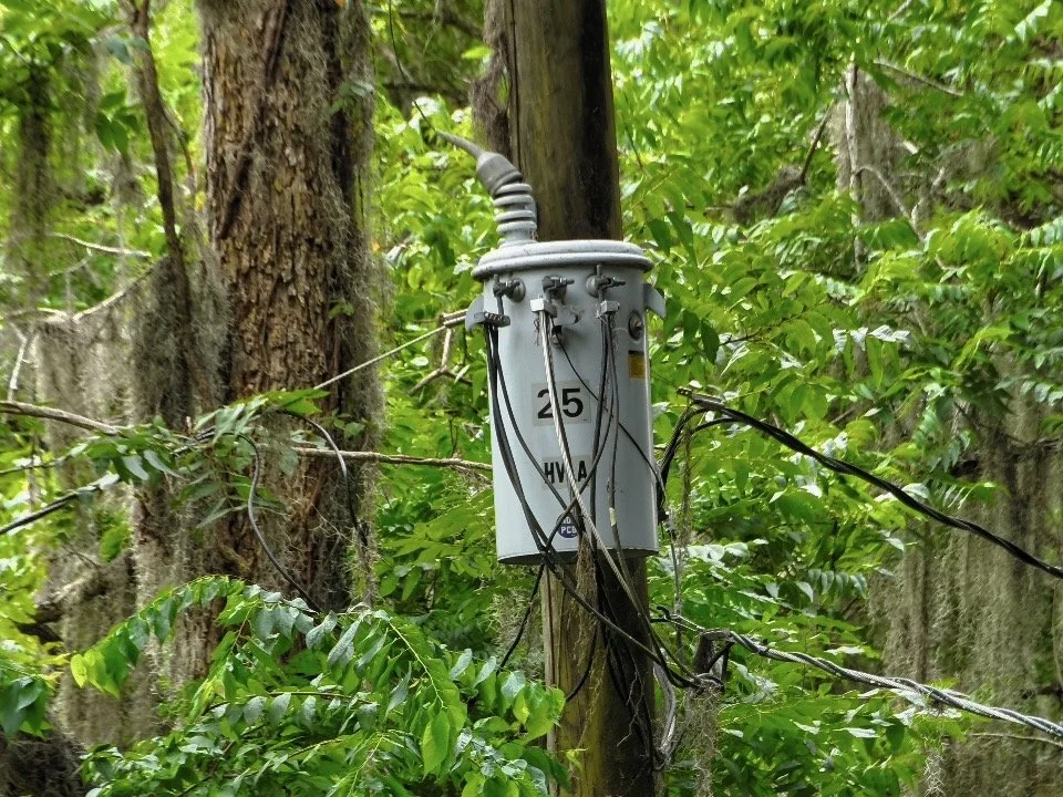
Power Pole Assessments
With high-resolution cameras, drones can inspect power poles and lines for wear, corrosion, or hazards without interrupting service. This helps utilities catch problems early and extend infrastructure life.
Benefits of Using Drones
Drones provide safer, faster, and more affordable inspections compared to traditional methods like bucket trucks or scaffolding. They minimize risk to workers, reduce downtime, and deliver precise data for proactive maintenance.
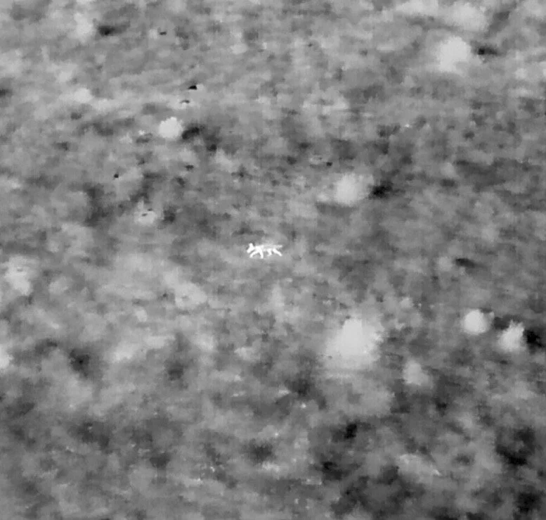
Search & Rescue
Pricing starts at $250 for local searches and additional fees for locations outside the area.
Lost Pets, Livestock & Missing Persons
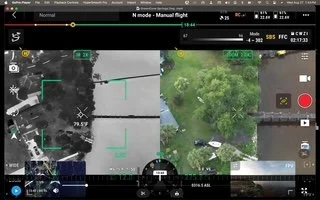
When a pet, farm animal, or loved one goes missing, time is critical. Our enterprise drones use thermal imaging and high-resolution cameras to cover large areas quickly, spotting heat signatures even in dense woods, tall grass, or at night. Drones can reach areas too dangerous, difficult, or time-consuming for people on foot, making the search safer, faster, and far more effective.
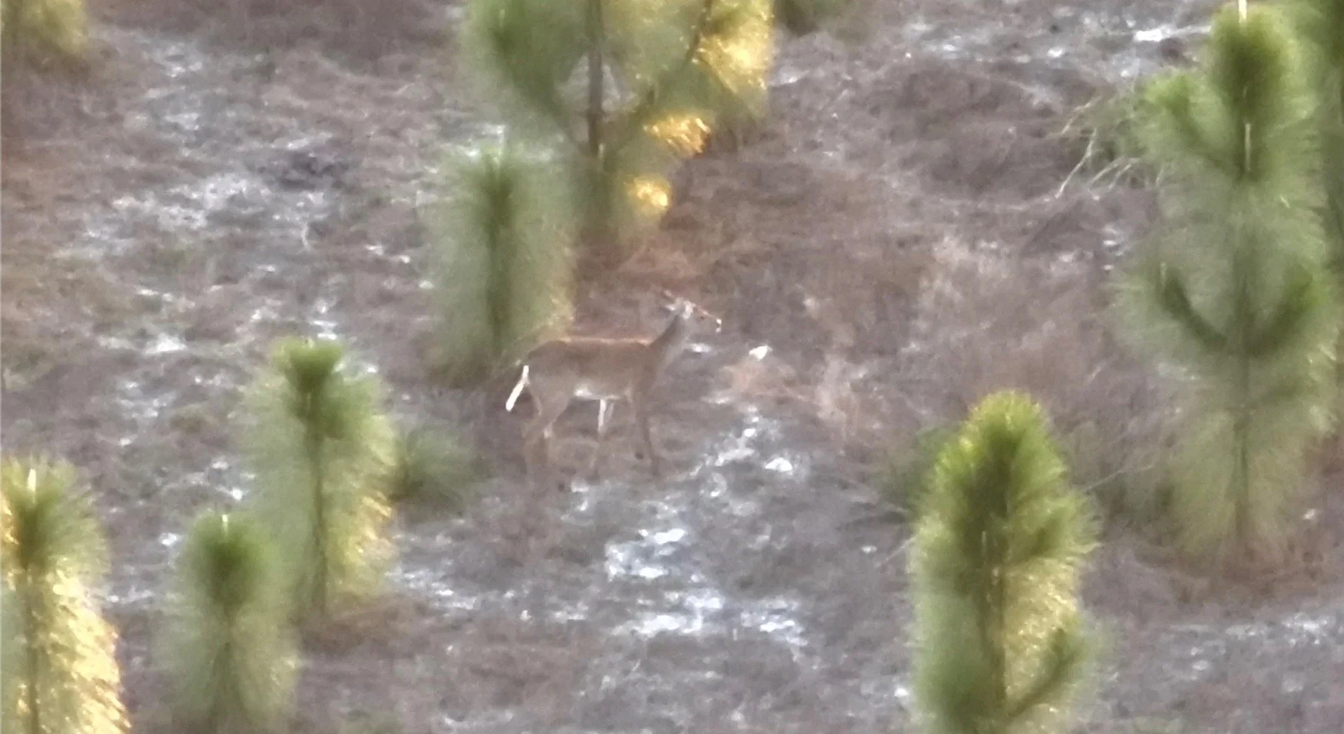
Game Recovery
After a hunt, finding downed game can be challenging—especially in thick brush or at night. Our thermal-equipped drones can scan fields and forests in minutes, locating animals with precision and reducing wasted time and effort. This not only helps hunters recover ethically but also prevents loss of valuable harvest.
Why Use a Drone?
Traditional search methods are slow, limited, and often miss what’s hidden. A drone can scan acres in minutes, fly over terrain people can’t safely reach, and detect heat that human eyes cannot see. This means more recoveries, faster results, and a safer, more efficient search every time.